GGeoNutshellGet the app ↗

SOUTH AMERICA / MAP PRACTICE

South America Countries Map Quiz

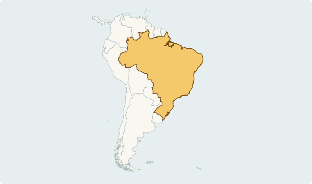
Explore South America in ten questions. Identify selected countries from their highlighted map shapes, then review the study guide and sample reference.

FREE WEB DEMO

No account. No ads.
Just a little discovery.

Explore the learning guide ↓
SELECTED SAMPLE · 10 QUESTIONSReady when you are
Sample map with a highlighted areaSimplified learning map · Natural Earth

YOUR NEXT SMALL DISCOVERY

How well do you know south america countries?

10 selected south america countries. Ten questions per round. You can replay the same sample as often as you like.

This is a browser demo, not the complete course.

Your latest result can be saved on this browser only.

Answers are not uploaded · No account or app sync

A SMALL TASTE OF GEONUTSHELL

Keep the world in your pocket.

This free browser sample contains ten selected countries. The app offers free major-country groups; complete country courses and other topics require Pro, available through an annual subscription or lifetime purchase.

Download for iPhone & iPad ↗

LEARN IT. DON’T JUST GUESS IT.

South America Countries Map Quiz: a short learning guide

Use these notes before a round, or return to the places you missed.

Reviewed 2026-11-13 · English edition

Use the Andes as a western anchor

Chile runs along the Pacific side of southern South America, while Argentina lies east of the Andes. Peru and Ecuador continue the Pacific-coast sequence farther north. Compare coastlines and neighbours before judging a country by its apparent map size.

Separate Paraguay from Uruguay

Paraguay is landlocked between Bolivia, Brazil and Argentina. Uruguay is farther south, between Brazil and Argentina, with an Atlantic coast and the Río de la Plata. Their similar names are less confusing when you attach each to a different location clue.

Look closely at the northern coast

Colombia is in the northwest and reaches both the Pacific and Caribbean. Venezuela is east of Colombia; Guyana is farther along the Atlantic coast. Guyana is not French Guiana. The reference table lists the ten countries selected for this exercise.

Geographic shapes: Natural Earth. Country names and capital reference: GeoNutshell country data. Sources, database licenses and credits. Natural Earth map source. The downloadable sample dataset is available as JSON; derived country database contributions are offered under ODbL 1.0. Report a correction.

A FEW USEFUL ANSWERS

Before you explore further

Does this test all of South America?

No. It contains ten selected sovereign countries. Bolivia and Suriname are not questions in this sample, and territories are not included as separate country questions.

Can I replay this regional sample?

Yes. The same ten questions can appear in a different order. Replaying does not unlock more countries or the full paid course.

Can I see the answers without installing the app?

Yes. Answer feedback, a round review and the sample reference table are available on this page. Installing the app is optional; browser progress does not sync to it.

What is saved or collected by this demo?

Answers and timing stay in this tab. Only the latest score and date may be stored on this browser; use “Clear saved result” to remove them. No account, tracking cookie or third-party analytics script is used by this demo. Normal web-server access logs still apply; see our privacy policy.